


On this route
January is the middle of Guatemala's dry season and, for most of the country a visitor sees, the most reliable month of the year. The highland numbers are the reason: the WMO climate normals for the Guatemala City station, at 1,500 m and a fair stand-in for Antigua and Lake Atitlan, give January a mean high of 23.8°C, a mean low of 11.5°C and 3 mm of rain on two days. The catch is not rain but range. The same trip that needs a fleece and a hat at dawn in Antigua puts you in 29°C by mid-afternoon in the Peten two days later, and the one real weather risk of the season, cold at altitude, applies to a single optional night on a volcano.
Short version: come in January, expect a dry, sunny highland month with cold mornings, plan the lake crossings and the transfers for the mornings because the daylight ends before 18:00, treat the Peten as a hot second climate, and read the volcano bulletins rather than the forecast before any hike. This article covers the month region by region and what it changes about a route; it does not repeat the day-by-day plan, which is in the 10-day Guatemala itinerary.
The highlands in January: Antigua, Lake Atitlan, Chichicastenango
Antigua sits at 1,545 m, Panajachel at 1,597 m and the lake surface at 1,562 m, all close enough to the capital's station for the normals to hold: days in the low to mid twenties, nights around 11 to 13°C, almost no rain. December is a degree cooler by day and slightly damper (23.4/13.1°C, 7 mm), February a degree warmer (25.2/12.9°C), and March warmer again (26.6/14.0°C, 7 mm). November is the transition, with 43 mm on six rain days, so a late-November arrival can still catch the tail of the wet season while a January one will not.
What this means in practice: the mornings are the best hours of the day, clear and cold. Chichicastenango, at 1,965 m, is colder again on a market morning. Many Antigua hotels are old colonial houses; ask whether the room is heated before you book, and pack a warm layer for the evenings either way. Sunrise in mid-January is 06:30 and sunset 17:54, about 11.4 hours of daylight, so a three-hour shuttle that leaves at 16:00 arrives in the dark.

The lake: wind, not rain
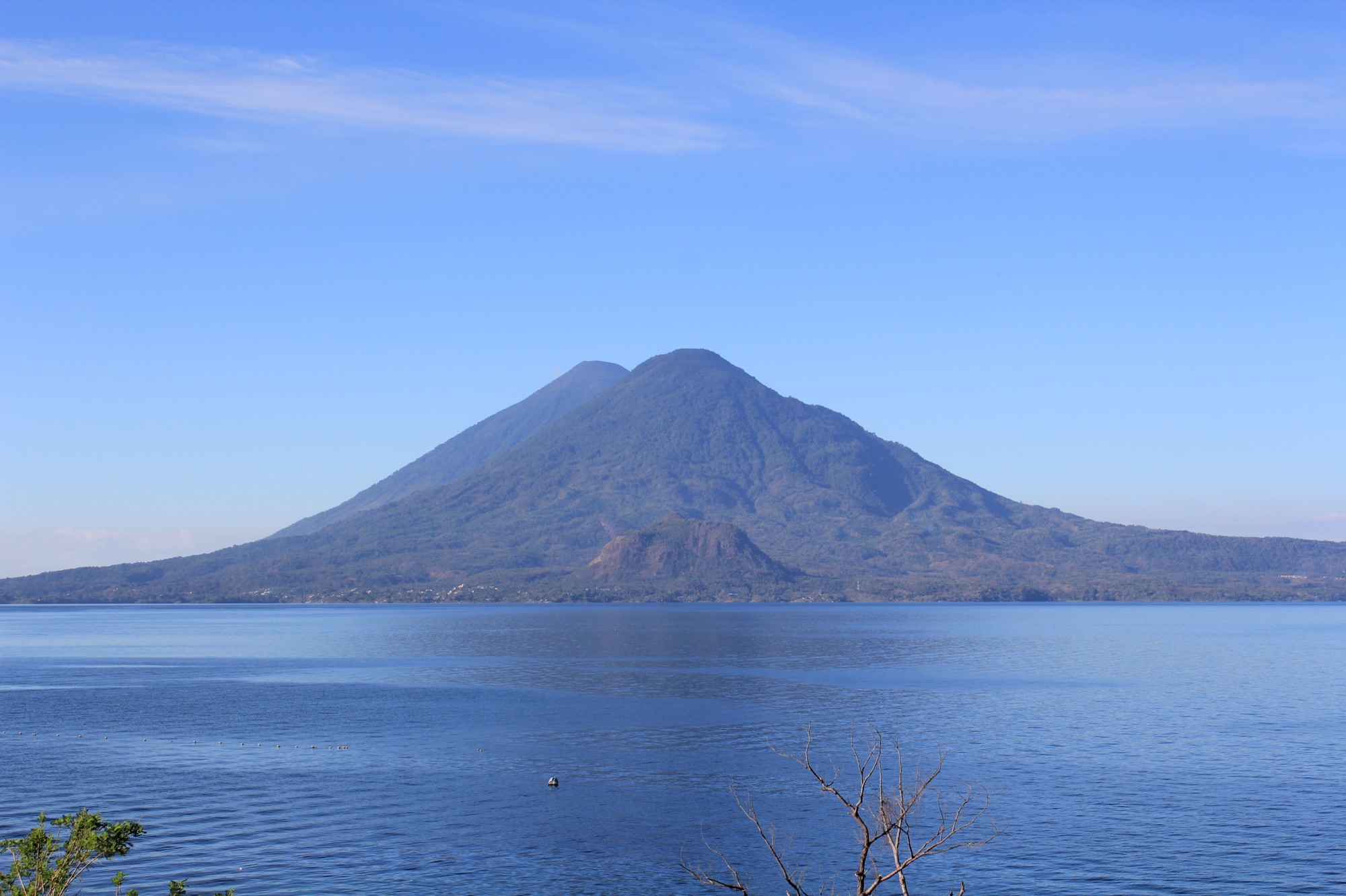
Lake Atitlan has its own daily weather. The Xocomil, a wind that builds across the water in the late morning and afternoon as Pacific air meets the cooler highland air, can be strong enough to make the public boats rough and even to capsize them. It blows in the dry season too, which is why the sensible January lake day is a morning crossing to San Juan, San Pedro or Santiago and a return by early afternoon. The FCDO adds a second reason to use the boats: it passes on PROATUR's advice that the water is the safer way between lakeside towns compared with the isolated shore roads. Public lanchas run roughly from 06:00 until about 17:00 and leave when they fill; there is no evening service, so the last boat home is a real deadline.
The Peten in January: hot, humid, and the start of the smoke
Flores and Tikal are a different climate. The 1991 to 2020 normals at the Flores airport give January a mean high of 29.0°C and a low of 18.0°C, with 66 mm of rain on about eight days; it is damper than February and March, and a short shower is normal. February (31.1°C, 35 mm) and March (33.5°C, 36 mm) are drier and hotter, and by April the afternoons pass 35°C. A record January low of 9.4°C shows that a cold front can reach the lowlands, so a light layer belongs in the bag even here.
Two seasonal notes belong in the plan. The Canadian government's advice says forest fires occur between November and June and that the Peten is usually the most affected area, with smoke that can lower air quality; in January the season is only beginning, but anyone with a respiratory condition should know it exists. And the CDC lists the Peten among the departments with malaria transmission while stating there is none in Antigua, Guatemala City or at Lake Atitlan, so the prophylaxis question applies to the Tikal nights only.
Volcanoes in January: cold camps and live bulletins
January's clear nights are the reason the Acatenango overnight is popular in the season and the reason it needs respect. The camp sits at about 3,750 m and the summit at 3,976 m; the operator lists night temperatures of 2 to 5°C and includes jackets, gloves and hats, and both the UK and Canadian governments warn of sub-zero conditions at altitude, hypothermia risk and the absence of any mountain rescue service. Book two to three days ahead in the December to March high season.
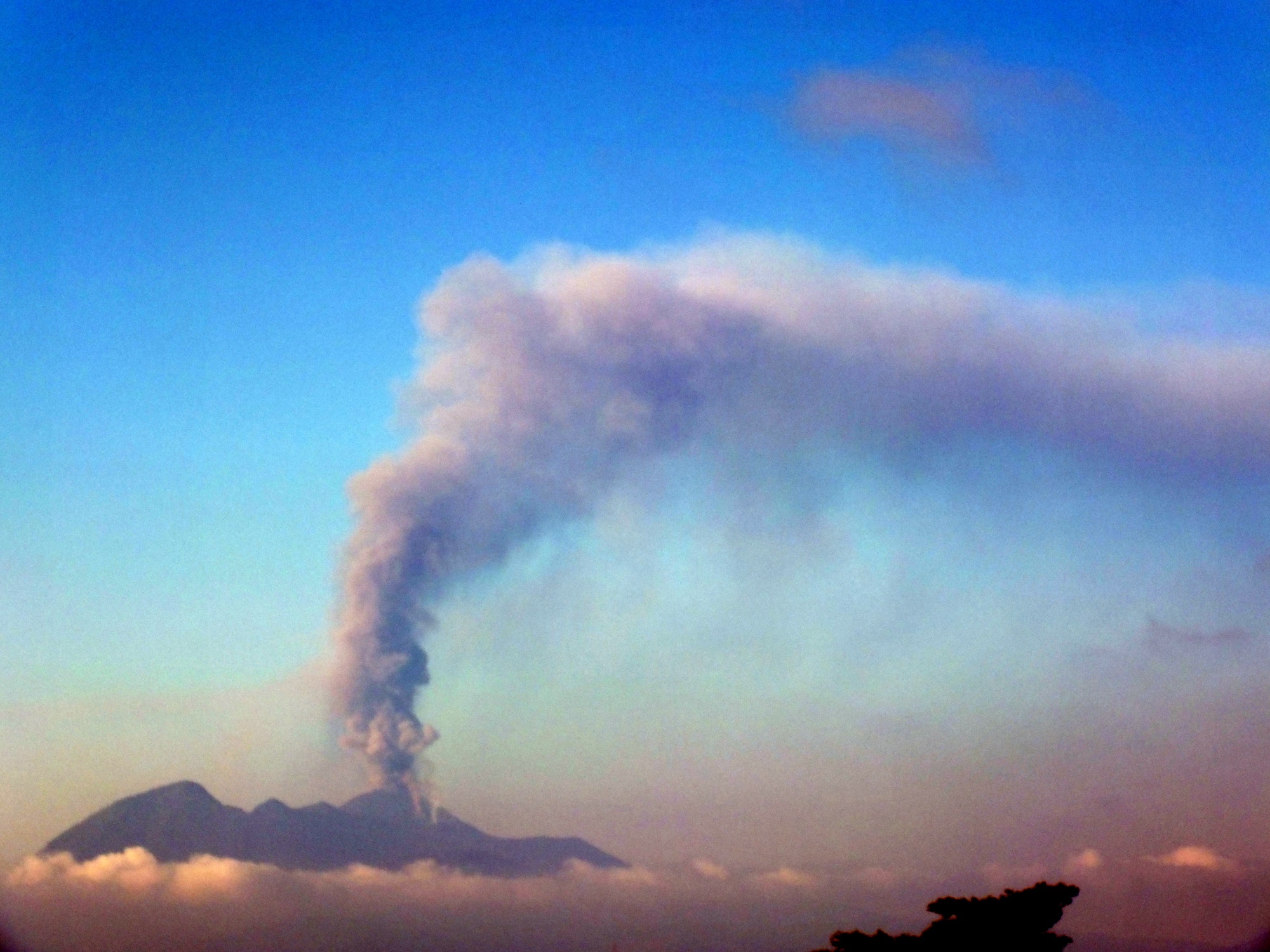
The other variable is the mountain itself. Volcan de Fuego, the active cone that Acatenango faces, erupted on 3 and 4 August 2026 with lava fountains, ash columns and pyroclastic flows down five ravines, and CONRED ordered evacuations; INSIVUMEH was still assessing the deposits at the end of August. Pacaya, the easier half-day hike from Antigua, has shown increased unrest since early 2026. Hikes were on sale in September 2026, but the FCDO's advice is the right one: check the INSIVUMEH and CONRED websites before climbing and follow the local decision on access.
Crowds and prices: the Christmas fortnight and the market days
The Antigua operators treat December to March as high season and warn that the Acatenango cabins sell out first, so the weeks around Christmas and New Year are the ones to book early; mid-January onwards has the same weather with less pressure on the popular tours. Chichicastenango's market keeps its Thursday and Sunday rhythm through the season, and the shuttle operators only run the market trip on those two days, so it is worth checking which weekdays your lake nights fall on before you book anything else.
What January changes about the route
| Decision | January answer | Why |
|---|---|---|
| Which way round? | Highlands first, Peten second, back to Antigua for the last night | Acclimatise at 1,500 m before any volcano; the hot lowlands are easier once the cold mornings are behind you |
| When to cross the lake | Mornings, back by early afternoon | Xocomil wind builds late morning; boats stop around 17:00 |
| When to transfer | Morning shuttles (05:30, 08:00 from Antigua; 05:00, 09:00 from the lake) | Daylight ends before 18:00 and the advisories favour daylight road travel |
| Which volcano | Pacaya as the default half day; Acatenango only with a clean bulletin and two days of acclimatisation | Fuego's August 2026 eruption, Pacaya's 2026 unrest, 2 to 5°C camp nights |
| Sunrise or day ticket at Tikal | Sunrise is the January option: cool, quiet, back by 12:30 before the heat | 29°C afternoons; the pre-06:00 ticket is Q250 against Q150 by day |
| Malaria tablets | Ask about the Peten nights only | CDC: transmission in the Peten, none in Antigua, the capital or at the lake |
How January compares with the rest of the season
November: the highlands are drying out (43 mm on six days at the capital's station) and the Peten is still wet (133 mm); good for a late-month trip, risky for early November. December: as dry as January in the highlands with cooler nights, but the Christmas fortnight is the crowd peak. January: the driest highland month with the coldest mornings, the Peten's last damp weeks. February: a degree warmer everywhere, the Peten drying fast, no holiday peak. March: hotter (26.6°C highland days, 33.5°C in the Peten), and in 2027 Semana Santa falls inside it: Easter Sunday is 28 March, so Antigua's Holy Week processions run from Palm Sunday on 21 March; book that week early. For the transfers themselves, which do not change with the month, see how to plan the long transfers; for the choice of where the extra night goes, Antigua or Lake Atitlan.
Guatemala in January FAQ
Is January a good time to visit Guatemala?
How cold does it get in Antigua in January?
Does it rain in Tikal in January?
Can I hike Acatenango or Pacaya in January?
Is Lake Atitlan windy in January?
Do I need malaria tablets for Guatemala in January?
What should I pack for Guatemala in January?
Photo credits
Hero: Antigua under Volcan de Agua by amslerPIX, CC BY 4.0, via Wikimedia Commons. Toliman and Atitlan from Panajachel by Arian Zwegers from Brussels, Belgium, CC BY 2.0, via Wikimedia Commons. Pacaya ash plume by Luisfi, CC BY-SA 3.0, via Wikimedia Commons. All resized.