


On this route
Fourteen days is the shortest trip that fits the South Island's three big set pieces, the West Coast glaciers, Milford Sound and Aoraki/Mount Cook, without a single five-hour driving day. Most published two-week routes get the towns right and the logistics wrong: they quote map times that ignore stops, put Fiordland after Queenstown and hand you a 4 h 19 drive to the Mackenzie on Day 12, and still describe a glacier walk that no longer exists. This plan is built from the NZTA journey planner's non-stop times, the Department of Conservation's current track pages and the rental companies' 2026/27 conditions, and it names the days that absorb bad weather.
The short answer: fly into Christchurch, sleep one night in the city, cross Arthur's Pass to Hokitika (1 night), drive down the coast to Franz Josef (2 nights), over the Haast Pass to Wanaka (2 nights), south to Te Anau for Milford Sound (2 nights), back up to Queenstown (3 nights), across the Lindis Pass to Aoraki/Mount Cook Village (1 night) and Lake Tekapo (1 night), then back to Christchurch for the flight home. That is 13 nights, eight beds, no leg over four hours non-stop, and a loop, so a campervan pays no one-way fee. If you would rather fly out of Queenstown, the open-jaw version below shows exactly what you give up.
- Duration
- 14 days / 13 nights
- Bases
- 8 (Christchurch loop)
- Transport
- Self-drive rental car or campervan
- Pace
- Balanced, with two weather buffers
- Best season
- December to March
Your 14-day route at a glance
| Day | Plan | Overnight | Driving (non-stop, NZTA planner) |
|---|---|---|---|
| 1 | Land at Christchurch, rest, stock up | Christchurch | Airport to city 15 to 25 min |
| 2 | SH73 over Arthur's Pass, Castle Hill and the Otira Viaduct on the way | Hokitika | 3 h 11 (plan 5 to 6 h with stops) |
| 3 | Down SH6, glacier valley walk in the late afternoon | Franz Josef | 1 h 51 |
| 4 | Lake Matheson at dawn or dusk, Fox Glacier, heli-hike if the sky allows (weather buffer) | Franz Josef | 30 min each way to Lake Matheson |
| 5 | Haast Pass with Blue Pools and the waterfalls | Wanaka | 3 h 52 (plan 6 h with stops) |
| 6 | Roys Peak at first light, or a gentler lake day | Wanaka | Local |
| 7 | South past Queenstown to Fiordland; fill the tank in Te Anau | Te Anau | About 3 h (2 h 59 planner); campervans via SH6 through Cromwell add about 15 min |
| 8 | Milford Road, Milford Sound cruise, back to Te Anau | Te Anau | At least 2 h each way; an 8-hour day |
| 9 | Milford fallback morning, then an easy drive to Queenstown | Queenstown | 2 h 07 |
| 10 | Glenorchy and a Routeburn day walk | Queenstown | 49 min to Glenorchy plus 25 min to the shelter |
| 11 | Queenstown rest or activity day, Arrowtown, Gibbston wineries | Queenstown | Local |
| 12 | Lindis Pass, Omarama, Lake Pukaki, evening at the Tasman Glacier viewpoint | Aoraki/Mount Cook Village | 3 h 09 (plan 5 h with stops) |
| 13 | Hooker Valley Track early, then Lake Tekapo and the dark sky | Lake Tekapo | 1 h 15 |
| 14 | Drive to Christchurch, return the vehicle, fly home | Flight | 2 h 46 to 2 h 54 (plan 3 h 30 plus the return) |
Where you sleep
- Christchurch 1 night
- Hokitika 1 night
- Franz Josef 2 nights
- Wanaka 2 nights
- Te Anau 2 nights
- Queenstown 3 nights
- Aoraki/Mount Cook Village 1 night
- Lake Tekapo 1 night
The planner times above are what the NZTA journey planner returned for each leg on a Saturday evening in September 2026, and the planner itself says they are indicative Google routings. They do not include photo stops, one-lane bridges, campervan speed or the coach in front of you on the Milford Road, which is why the plan column adds an hour or two to every long leg.
Who this route suits, and who should change it
It suits a first South Island trip in the southern summer by two to four people who will drive, want Milford Sound and Mount Cook in the same fortnight, and can live with one glacier base rather than a week on the West Coast. It works equally in a car or a self-contained campervan, with three differences the campervan-versus-car comparison spells out: the Crown Range is off limits to rental motorhomes, the Rob Roy Glacier road is too, and the Wanaka and Queenstown nights must be holiday parks or designated car parks.
Change it if your international flight lands in Queenstown rather than Christchurch (alternative C), if you have 12 days rather than 14 (cut the second Queenstown day first), or if you want Kaikoura, Abel Tasman or Dunedin, none of which fit inside 14 days without dropping a glacier or Fiordland. Readers who prefer a quieter base than Queenstown for the last three nights should read Queenstown or Wanaka before booking; this route uses Wanaka early and Queenstown late for reasons of road access, not preference.
Six decisions to make before you book
1. Loop or open-jaw. The loop above returns to Christchurch. The open-jaw version (Christchurch in, Queenstown out) drops the Mount Cook and Tekapo nights and saves about 5 h 15 of driving, but you lose the Hooker Valley Track and pay a one-way fee: thl (Britz, maui, Apollo) charges $200 for Christchurch to Queenstown in the 2026/27 season, and car companies usually add a charge too. If Mount Cook matters, keep the loop.
2. Clockwise or anticlockwise. We go West Coast first and finish in the Mackenzie basin because the Mackenzie is the driest, most reliable part of the island (Lake Tekapo averages 38 mm of rain in January against 257 mm at Hokitika and 419 mm at Mount Cook village, per NIWA's 1991 to 2020 normals) and it is where your fixed flight day sits. A rained-out glacier day on Day 4 has Day 5's Lake Matheson dawn as a fallback; a rained-out Mount Cook day on Day 13 has none.
3. Te Anau before Queenstown. Many published routes do Queenstown then Te Anau then Mount Cook, which produces a 4 h 19 non-stop day from Te Anau to Twizel. Going Wanaka to Te Anau (2 h 59) and Te Anau to Queenstown (2 h 07) first, then Queenstown to Mount Cook (3 h 09), spreads the same kilometres over three days and gives the Milford day a fallback morning.
4. The Milford day. Book a midday cruise (RealNZ's Signature Cruise runs at 10.30 am, 1 pm and 3.25 pm and cost NZD 175 per adult when we checked; Southern Discoveries' Nature Cruise was from NZD 179) and leave Te Anau by 8 am for a 1 pm sailing. DOC says the 240 km round trip is an eight-hour day with stops and a cruise, and after the record 2025/26 summer it advises allowing 45 minutes for parking and the walk to the terminal. There is no fuel after Te Anau.
5. Mount Cook Village first. The village has a handful of beds and one DOC campsite, White Horse Hill ($20 per adult per night, bookings required, no walk-up spaces, often full and busiest from Christmas to mid-February). Book that night before anything else; if it is gone, Twizel, an hour south, is the fallback and has the nearest supermarket and dump station.
6. Car or campervan. For two people on these dates a car with rooms came out cheaper by roughly NZD 1,200 to 3,600, and the campervan's freedom is less than the brochures suggest since the June 2026 self-containment rules; for a family of four the two options land in the same range. The separate comparison prices both on this exact route.
Day-by-day plan
Day 1: Christchurch, arrival night
Long-haul arrivals from North America either connect through Auckland or, from 4 December 2026 to 26 March 2027, take United's planned three-weekly nonstop from San Francisco; either way you land tired. Sleep in the city, walk the Botanic Gardens, buy groceries and a chilly bin, and collect the vehicle on the morning of Day 2 (or this afternoon if you want the shopping done in the car). Campervan depots are off-airport (check your operator's pick-up address and shuttle); cars are at the terminal.
Day 2: Arthur's Pass to Hokitika (3 h 11 non-stop)
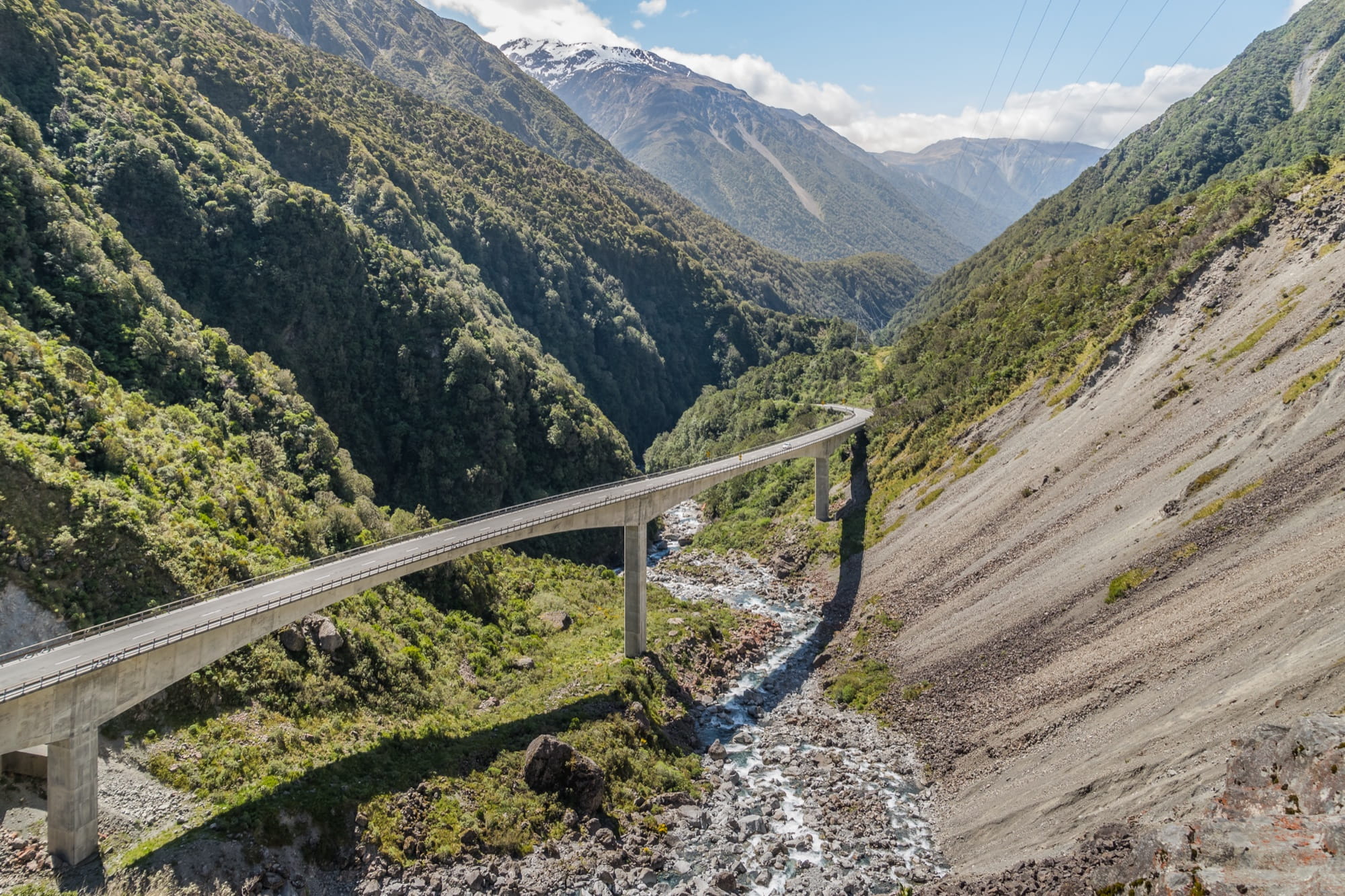
Fill the tank before you leave the plains. SH73 climbs through the Castle Hill limestone (Kura Tawhiti, a 20-minute wander) to Arthur's Pass village, then drops through the Otira Gorge on the viaduct with a lookout at the top. Hokitika has the beach, the driftwood sign and enough restaurants for one night; Hokitika Gorge is an optional inland detour if you arrive early and the sky is clear. Plan five to six hours door to door with stops.
Day 3: Hokitika to Franz Josef (1 h 51)
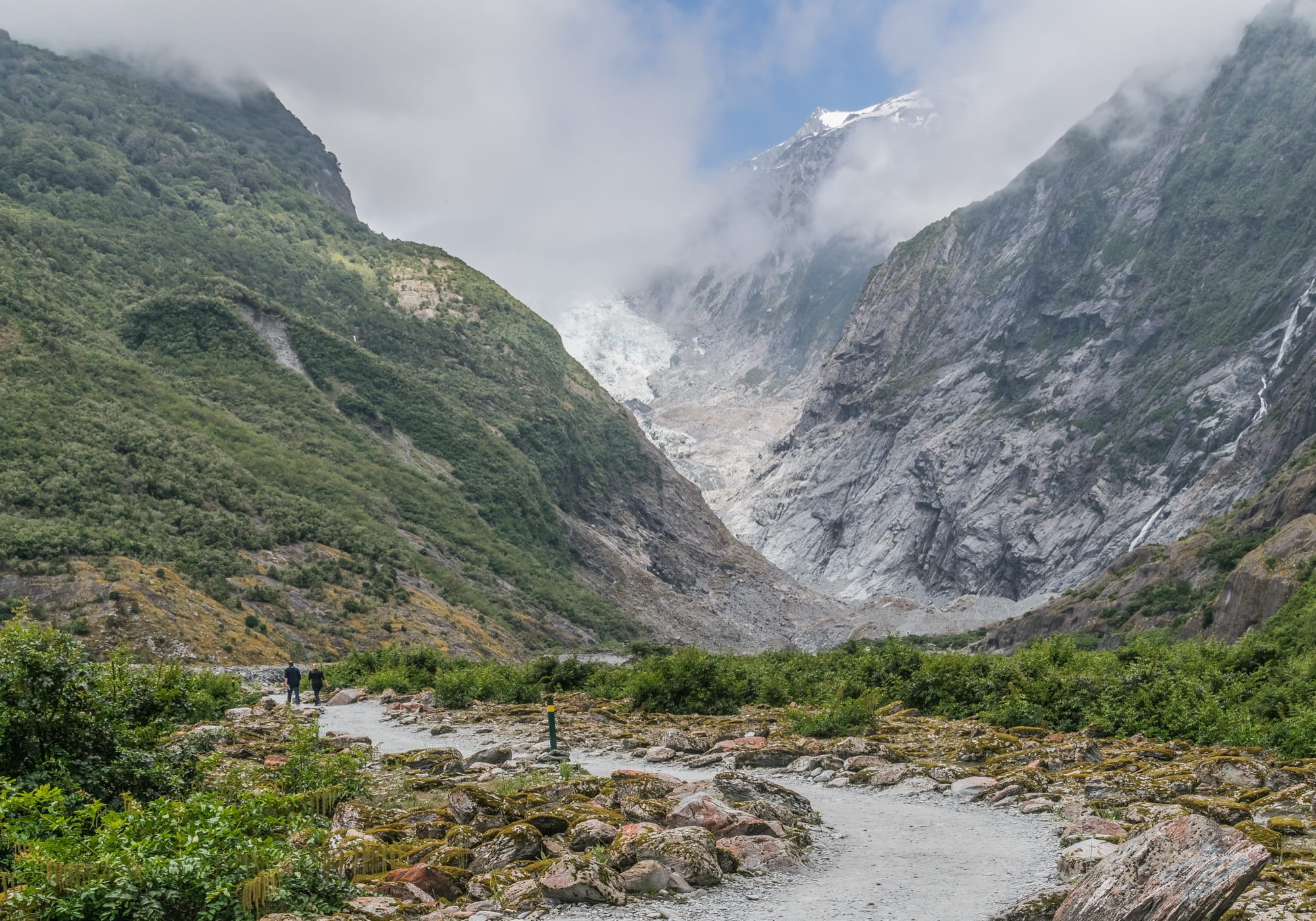
An easy morning down SH6 past Ross and Lake Ianthe. Check in, then drive 4 km up the Glacier Access Road for the Franz Josef Glacier / Ka Roimata o Hine Hukatere Walk. Be warned that it is not the walk in older guides: the Waiho River has cut off access up the valley, so DOC now lists it as 1.7 km and 30 minutes return to a viewpoint of the valley and the upper glacier. Parking costs $2.50 per half hour or $20 a day, cards only. Call at the national park visitor centre in town for tomorrow's track status.
Day 4: Franz Josef and Fox, the West Coast buffer
This is the day the West Coast rain is allowed to fall on. On a still morning or evening drive 30 minutes south to Lake Matheson for the 4.4 km, 1 h 30 loop; the mirror only works without wind, so dawn and dusk are the times, and the sandflies are as fierce as DOC says. Fox Glacier township is five minutes back towards the highway. If you want to stand on ice, book a heli-hike from either town; weather cancels often, so never book it for the morning you leave. Gillespies Beach fills a spare afternoon.
Day 5: Haast Pass to Wanaka (3 h 52)
The longest non-stop leg. Fuel in Franz Josef or Fox; Haast has a pump; after that do not count on fuel until Wanaka. Knights Point and the Ship Creek boardwalks are the coastal stops, then SH6 turns inland up the Haast River past Thunder Creek Falls and Fantail Falls. Blue Pools, 10 km before Makarora when you come from Haast, is a 3.2 km, 1 h 30 return walk whose car park fills mid-day in January, so it is a late-afternoon stop if you left at nine. Six hours door to door is realistic.
Day 6: Wanaka
Roys Peak is the big walk: 5 to 6 hours return, more than 1,200 m of climb to 1,578 m, no shade and no water, and a free car park that fills. Start at first light, which in January is about 6 am, to be down before the heat. It is open all summer (the lambing closure is 1 October to 10 November). If that is too much, the Diamond Lake and Rocky Mountain loop or Isthmus Peak are the alternatives, and Rob Roy Glacier is a car-only option because the unsealed Mt Aspiring Road past Treble Cone is banned for rental motorhomes.
Day 7: Wanaka to Te Anau (about 3 h)
Drive straight past Queenstown. Cars take the Crown Range (the Cardrona Hotel is the stop); campervans must use SH6 through Cromwell and the Kawarau Gorge, about 15 minutes longer. Both routes join at Frankton and follow the lake to Kingston, then Lumsden and Te Anau. Fill the tank in Te Anau tonight, confirm the cruise, and look in at the Fiordland National Park Visitor Centre for the road forecast.
Day 8: Milford Sound
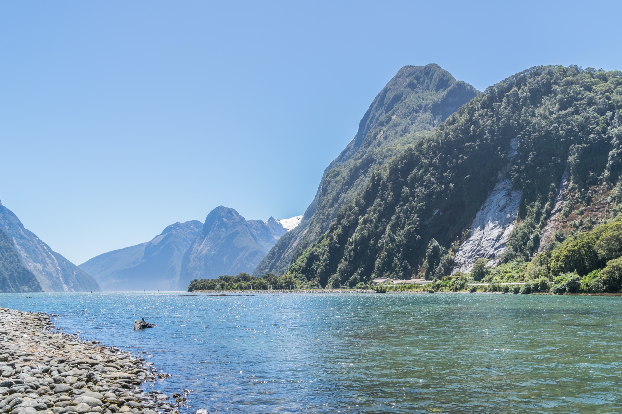
Leave by 8 am. NZTA puts the 120 km at a minimum of two hours non-stop; with Mirror Lakes, the Eglinton Valley, Monkey Creek, the Homer Tunnel and The Chasm it is closer to three. The tunnel runs on traffic lights in summer with waits of up to 20 minutes, and inside the avalanche zone you may stop only at the two signposted areas. Cruise, then drive back with the Key Summit walk from The Divide as an option if the legs and the light allow. Mobile coverage ends at Te Anau; check the journey planner or 0800 44 44 49 before you set off.
Day 9: Te Anau to Queenstown (2 h 07), the fallback day
If the road was closed or the fiord was fogged in yesterday, go today: leave at 7, cruise at 1, and you are in Queenstown by 8 pm with light to spare, because the sun sets around 9.30 pm. Otherwise walk the first hour of the Kepler Track from the control gates, have a slow lunch, and arrive in Queenstown early. The Devils Staircase lookout above Lake Wakatipu is the one stop worth making.
Day 10: Glenorchy and the Routeburn
The Glenorchy road is 49 minutes of lakeside driving, then about 25 minutes more, the last part gravel, to the Routeburn Shelter. The Routeburn Flats day walk is 7.5 km one way (DOC says 1 h 30 to 2 h 30 each way) through beech forest to an open valley, and unlike the Great Walk huts it needs no booking. Take lunch; nothing is sold beyond Glenorchy.
Day 11: Queenstown
A rest or activity day: the gondola and Ben Lomond saddle, a lake cruise, Arrowtown (20 minutes) or the Gibbston Valley wineries (25 minutes). This is the night to cut first if you only have 13 days.
Day 12: Lindis Pass to Aoraki/Mount Cook (3 h 09)
SH6 through Cromwell, SH8 over the Lindis Pass with its summit lookout, Omarama (the Clay Cliffs are a short gravel detour across private land), then the long blue reach of Lake Pukaki and SH80 up its western shore to the village. Fuel in Cromwell or Omarama. Arrive by mid-afternoon; the Tasman Glacier viewpoint is a short evening walk, and the light on Aoraki after 8 pm is the reason to sleep here rather than in Twizel.
Day 13: Hooker Valley, then Lake Tekapo (1 h 15)
Start the Hooker Valley Track by 7.30 am from the White Horse Hill car park. It is about 5 km each way on gravel with a few steps, roughly three hours return, past Mueller Lake and over the new 189 m second swing bridge, the longest in the country, that opened in July 2026. Parking is $2.50 per half hour or $25 a day unless you camped. Then Lake Pukaki's southern shore, Tekapo's Church of the Good Shepherd and Tekapo Springs. Tekapo is the driest, sunniest night of the trip (267 sunshine hours in an average January), so save the stargazing in the Aoraki Mackenzie dark sky reserve for tonight; true dark arrives after 10 pm.

Day 14: Tekapo to Christchurch (2 h 46 to 2 h 54), fly home
No sightseeing today. Fairlie or Geraldine for a bakery stop, then SH79 and SH1 to the airport. Allow 3 h 30 plus the vehicle return, and for a campervan another 45 to 60 minutes for the return inspection after emptying the toilet cassette and grey water at the Twizel public dump station (the nearest to Mount Cook) on Day 13 or at one in Christchurch. This suits flights after about 3 pm. For a morning flight, swap the Tekapo night for a Christchurch night and drive Mount Cook to Christchurch (about four hours) on Day 13 after the Hooker Valley.
Booking order and what fills first
Book in this order: the Mount Cook Village or White Horse Hill night (bookings open for stays to 30 June 2027 and the campsite keeps nothing for walk-ups), the vehicle, then Franz Josef and Te Anau, which have few beds for their visitor numbers, then the Milford cruise, then everything else. Great Walk huts are a different matter: the 2026/27 season runs from 1 November to 30 April, bookings opened on 13 May (Milford Track), 15 May (Routeburn) and 19 May (Kepler) 2026, and the popular summer dates went quickly. This route uses day walks on the Routeburn and Kepler that need no booking. Holiday parks between Christmas and early February also sell out; New Zealand schools are on holiday from about 18 December until the last days of January.
Best time for this route
The window is December to March. January is the warmest and busiest month: mean temperatures sit between 15 and 17 degrees at every base, days run from about 6 am to 9.30 pm, and school holidays push prices and occupancy to their peak until the end of the month. February keeps the warmth with fewer people once schools return, and the West Coast is drier (Hokitika 192 mm against 257 mm in January). March is quieter still and the Roys Peak and Hooker Valley mornings are cooler, but the days are shorter (about 12 h 30 of daylight by mid-March against more than 15 in early January). December has the lupins at Tekapo and the longest days, and the Christmas fortnight is the hardest to book of all. The January planning guide goes region by region.
Shorter, reversed and open-jaw versions
A. Christchurch in, Queenstown out (12 days). Run Days 1 to 11 unchanged and fly out of Queenstown on the morning after Night 11. You lose Mount Cook and Tekapo and pay the one-way charge. With 14 days in hand, add the two nights to Franz Josef and Wanaka rather than to Queenstown.
B. Anticlockwise (Mackenzie first). Christchurch, Tekapo, Mount Cook, Queenstown, Te Anau, Wanaka, Franz Josef, Hokitika, Christchurch. The same nights, but the last full day is a glacier day with no fallback and the final morning is the 3 h 11 Arthur's Pass crossing. Only do it if your flights or bookings force it.
C. Queenstown in and out. There are no nonstop flights from North America to Queenstown, so you connect through Auckland either way. Start with Wanaka, the West Coast and Arthur's Pass, come back through Tekapo and Mount Cook, and finish with Te Anau and Queenstown. It adds the Christchurch to Mackenzie leg and a repeat of Queenstown; worth it only when the Queenstown fare is much cheaper.
D. Thirteen days. Drop Day 11. Twelve days. Also drop the Hokitika night by driving Christchurch to Franz Josef in one five-hour push, which we do not recommend on the day after a long-haul flight.
What to leave for another trip
Kaikoura is 2 h 19 north of Christchurch and needs two nights to do the whale watching and get back across to the West Coast by the Lewis Pass. Punakaiki's Pancake Rocks are under an hour north of Greymouth, the wrong direction on Day 2. Dunedin, the Catlins and Stewart Island are a separate southern loop. Abel Tasman and Marlborough belong to a trip that starts in Picton or Nelson. Milford Track and Routeburn overnight huts need bookings made the previous May. None of these are worth a five-hour driving day inside a fortnight.
Common mistakes
Planning the Milford day from Queenstown (four to five hours each way, a 12 to 14 hour day) instead of sleeping in Te Anau. Booking the glacier heli-hike for the morning you leave. Arriving at White Horse Hill without a booking. Trusting a map time for the Haast road. Driving the Crown Range in a rental motorhome. Assuming any van with a bed can freedom camp: since 7 June 2026 that needs the green warrant and a fixed toilet, and even then Queenstown and Wanaka's urban areas are off limits. Leaving Te Anau on the Milford morning without a full tank. Underestimating the sun: the UV index in a South Island summer is high, and Roys Peak has no shade.
Frequently asked questions
South Island itinerary: quick answers
Is 14 days enough for the South Island?
Should I fly into Christchurch or Queenstown?
How long is the drive from Te Anau to Milford Sound?
Can I walk to the Franz Josef Glacier?
Do I need to book the Hooker Valley Track?
Is January a good time?
What documents do I need to enter and drive?
Can I do this route in a campervan?
Photo credits
Hero: Hooker Valley, Aoraki/Mount Cook National Park, by Bonito Coquito, CC BY-SA 4.0. Otira Viaduct, Franz Josef glacier valley, Milford Sound and Lake Pukaki by Krzysztof Golik, CC BY-SA 4.0. All via Wikimedia Commons, resized.